Location Gallery
Ghaghari Dham Waterfall


Ghaghari is a small Village/hamlet in Lapung Block in Ranchi District of Jharkhand State, India. It comes under Dewgaon Panchayath. It is located 50 KM towards west from District head quarters Ranchi. 49 KM from State capital Ranchi.Ghaghari is surrounded by Bharno Block towards west , Karra Block towards East , Bero Block towards North , Kamdara Block towards South. Khunti, Ranchi, Gumla, Lohardaga are the near by Cities to Ghaghari.
This Place is in the border of the Ranchi District and Gumla District. Gumla District Bharno is west towards this place . Also it is in the Border of other district Khunti .
Getalsud Dam


Getalsud Dam is an artificial reservoir situated in Ormanjhi, Ranchi, Jharkhand. It was constructed across the Subarnarekha River and was opened in 1971. It is a popular picnic spot for the residents of Ranchi and Ramgarh District. The dam provides a small-scale fishing opportunity to the local people of Rukka.
Sitarampur Dam


Sitarampur Dam
Garga Dam
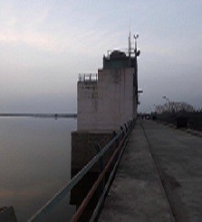

Garga Dam, Bokaro Steel City Overview. Garga is a tributary of the Damodar River that flows on the southern parts of the city of Bokaro. A dam was constructed on it in the 1950s to make it the first such river valley project in the country.
Palna Dam


Palna Dam is built across the Subarnarekha River and is situated in the Chandil town of Seraikela.
Gua Fall


Gua is a small census town in the district, which is famous for a waterfall, situated approximately 6 km from Chatra town, while travelling towards Maloodah. This waterfall falls down from a height of 30 ft and is covered with rocks on all the three sides. In the middle of the waterfall, there is a reservoir or stream, where people take dip on every Monday during the Shravan month.
Jhariya Dam
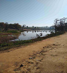

Jhariya Dam
Jonha Falls


About 45 kms away from Ranchi situated on the Ranchi-Purulia Highway, is the Jonha Falls, named after the local village. It is also known as the Gautamdhara, as there is a temple dedicated to Lord Budha, in its vicinity. The rocks here seem to beckon you down its natural gradient to join the frothy gurgling water of the River. The fall appears relatively more somber, enhancing the picturesque charm of the spot.
How to Reach
The site is well –connected with both rail and bus routes.
Nearest Rly. Station:- Jonha Station is 1.5 km away from Jonha Fall
By Road: Take the Ranchi-Purulia Road and after traveling 32 kms then travel about 4.8 kms off main road
Distance from Ranchi:- 40 kms
Sita Fall


Through it is one of the lesser known waterfalls, none the less your trip of the waterfalls in Ranchi is incomplete without a visit here. Being close to Jonha, it is not difficult to reach either. The rocky gradient down where the water trickles, seems to have been sculpted by none other than Nature herself. The view caresses away both your physical and mental strains, leaving you recharged as the fresh and foaming waters of the falls.
The site is well connected with both rail and bus routes.
Nearest Rly. Station:- Jonha Station is 1.5 km away from Jonha Fall
By Road: Take the Ranchi-Purulia Road and after traveling 32 kms then travel about 4.8 kms off main road
Distance from Ranchi:- 40 kms
Nearest Airport : Ranchi
Netarhat Dam


Located
at a distance of 1.5 kms – 2 kms from the Netarhat bus-stand the dam
owes its origin time the day of British Raj. It is a perennial dam and
continues to supply water in the region, even to this day. Spread over
an expanse of 4 sq kms it is set at the backdrop of tall pine grasses
and hills. An ideal spot for picnic the placid waters of the lake tempt
out to go for boating as well. Not to forget , the lake is also the home
to a large variety of fish. So, you can simply go fishing and pick up
those Rehus, Katla, Mrigal, etc. from the dam, thereby adding more spice
and gravy to your picnic. You can even just sit back by the side of the
dam and enjoy the view of the various species of local birds that side
down the water for a quick search of fish of their choice.
Chandil Dam


Situated
22 kms north of Jamshedpur, the multi-purpose project on River
Subarnarekha, is an irresistible site for water sports and adventure,
with the scenic Dalma Hills towering in the background. Boating is a
popular activity with visitors, especially in the winter months.
Lodh Waterfalls


It
was once a chosen destination for the British Laat Sahebs to unwind.
The remains of Laat Bangla exists to this day. The site about 61 kms
away from Netarhat and 14 kms north West of Mahuadand near Orsapat, in
latehar district proudly claims to have the highest waterfalls in
Jharkahand. Here the water of the River Burha, as it is locally called
makes a spectacular leap from a height of about 468 feet. It falls from
two sides of the hills, thundering its way deep into the bosom of the
earth. A legend runs that the local villagers once tried to measure its
depth by immersing boulders tied to long ropes, the span being
equivalent to that used in the making of seven Khatias, (coir costs)…
But alas! The boulder disappeared deep down in the abyss… and even to
this day the depth is unfathomed. The place is called Chitidah. The
roaring sound of the water falls amidst rocky terrains and hills, inside
the forests, can be heard even from a distance of 10 kms away. River
Burha is later joined by a number of wild rivulets emerging from the
local hills around.
Lower Ghagri


Lying
about 4-5 kms below the Upper Ghagri, is the Lower Ghagri, about 10-12
kms from the Netarhat Bus stand. Here, Local rivulets, originationg from
the hillocks add on to the volume of water from Upper Ghagri, tumbling
down from a height of about 100 feet. For nature lovers, the trek to
Lower Ghagri may be equally fascinating. It is through the dense forests
where large branches of trees serve as bridges over the short brisk
rivulets. Taking you to the site are three four such wooden pathways.
The tall trees of the forests are endowed with such thick luxuriant
growth that even the sun rays are unable to pierce through them---
making them reminiscent of the American poet, Robert Frost’s description
of lovely, dark and deep woods, the gushing sound of the water seems to
shatter the prevailing tranquility. Not to forget, you might also be
fortunate enough to catch a fleeting glimpse of the wild life as Tiger,
bear, deer, peacock, wild goats etc. in the forests.
Hatia Dam


Although
it is called Hatia Dam, it is actually located in the Dhurwa region of
Ranchi, covering and expanse of 7 sq. kms. Besides being a prominent
tourist destination, the water of the dam caters to a huge population in
the region. It is a about 15 Kms from the city. The dam has gazebos on
one side, where one may sit and enjoy the cool breeze by the dam. The
slop of the dam has stones set on the soil that provides a good grip
while descending down to the waters of the dam. It is thus a favorite
site for a quick swim, or simply for boating. The dam is also ideal for a
view of the setting sun.
Lawapani Waterfall


???????? ???????? ??????? ???? ???????? ?? ?????? 36 ?????? ?? ???? ?? ?????? ??????? ??? ??????? ??, ???? ???????? ?? ???????, ?????? ???? ??? ???????? ??? ????? ?? ?????? ?? ???? ??? ????? ?? 112 ??????, ??????? ?? 116 ?????? ??? ??????? ?? 25 ?????? ?? ???? ?? ????? ?? ? ?? ?????? ????? ?? ??? ??? ???? ? ??????? ?? ???? ?? ????? ???????? ??? ?? ???????? ?? ??????? ?? ?? ?? ???? ??? ?????? ? ?? ?? ??????? ??? ??? ????? ?? ?????? ???? ?? ?? ???? ??, ?? ??? ???? 12 ????? ??? ?????? ?? ?????? ??? ?????? ? ????? ??? ??????? ?? ???? ??????? ????? ????-???? ?? , ?? ??????? 10 ??? ?? ???? ?????? 80 ??? ???? ???? 30 ??? ??? ?????? ?? ??????? ??????? ??? ?????? ?????? ?? ?????? ?????? ????????? ??????? ?? ???? ?? ?? ?? ???????? ?? ?????? ?? ?? ???? 268 ???? ???? ???? ?? ???????? 60°-70°?? ??? ????? ??? ???????? ???? 110 ???? ?? ?????? ?? ????? ???
???? ?? ????? ??? ???????, ????????????, ????????? ???????????, ??????? ????? ? ??????? ?? ????? ??????????, ???? ??????? ?????? ?? ??????, ??? ??? ???? ?????? ????????? ???????? ?? ?????? ?? ?? ??????? ?????? ???
???????? ???????? ??? ?? ?? ??? ??? ?? ??? ?? ???? ???? ??, ????? ??? ?????? ???? 30 ???????? ??? ???????? ?? ??????? ?? ?? ?? ??? ?????-?????? ???? ?? ?? ???????? ???? ??? ???? ????? ??? ????? ?? ??? ?? ????? ??????? ????? ?????? ?? ???? ???? ????? ???? ????? ?? ????? ??? ??? ?????? ?? ???? ???
?? ???????? ???? ?? ?? ???-??? ? ???? ?????? ?? ???? ??? ???? ????????? ???? ???? (1000+ ???? ) ???? ?????? ?? ?????? ??? ????? ??? ???? ?????? ??? ????? ???? (900 ???? ), ?????????? ???? (800 ???? ), ????? (700 ???? ), ?????? (800 ???? ) ??? ????? ?? ???? (700 ???? ) ??? ??? |
??????? ??????? ??? ????? ???????? ?? ????? ??? ?????? ??? ???? ???
??? ?? ?? ??????? ???????? ???? ?? ??? ???????? ???
?? ???? ??? ?????? ?? ????????? ??? ???? ??????? ??????? ???????? ?? ?????? ????? ?????? ?????? ???
???? ?? ?????? ??????????, ????? ??? ????? ?? ???????? ??????? ???? ???????? ??? ?????? ????
??? ??????? ???????:-
(1) ???? ???? :- ???? ???????? ??????? ?? 38 ?????? ?? ???? ?? ?????? ??????? ??? ??????? ??? ???? ???????? ?? ???????, ?????? ???? ??? ???????? ??? ????? ?? ?????? ?? ???? ???
??? ??????? ?? ???? ????? ?? -??????? ? ????? ?????????????? ??????????
(2) ?? ???? :- ??????? ?? ???
Panch Ghagh Falls
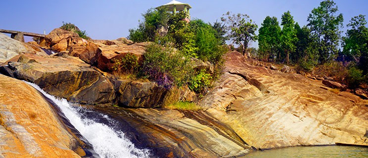

Located
on the way to Simdega on the Ranchi-Chaibasa Road, it is about 50 kms
from the state capital. Being a series of five waterfalls in a row the
destination is known by the name of PanchGhagh or even PanchDhara. It is
an ideal picnic spot amidst lush greenery. The cascading water of
Swarnarekha, foaming through the naturally occurring gradual terrain of
the rock is a sight to behold. The place is usually frequented by the
revellers on the New Year’s eve. It is in the vicinity of the Hirni
Falls.
Hirni Falls
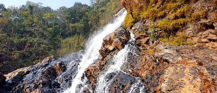

It
is another fascinating waterfall with tranquil surroundings; It is
situated 70 kms from Ranchi on way to Chakradharpur. Situated amidst
dense forests, River Swarnarekha, tumbles in wild abandon from a
considerable height as a Hirni or wild deer. The cracks, crevices and
the chasms across the mountain ridges or the tall trees that obstruct
the general course of the river have split it into a number of miniature
rivulets that restlessly meander their way down. It is however ideal
for a day visit, given the dense forests around.
Burudih Lake
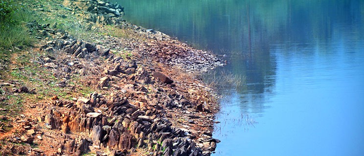

Flanked by hillocks, the Burudih Lake in the Ghatshila Block in East Singhbhum is a favourite site for water sports. There are facilities for motor and pedal boating, with upcoming provisions for water surfing and banana rides. The hillocks surrounding the lake are a part of the oldest rock site in the world. The forests covering the low hills are a part of the elephant corridor from the Dalma range to Midnapur in West-Bengal.
You may be lucky to spot trekking elephants, along the hills. From the railway station auto rickshaws are easily available for reaching Burudih Lake.
Ghatsila is 136 kms from Ranchi. Burudih lake is 9 kms from Ghatsila Block.
Sarju Valley


Sarju
valley is located at Garu block of Latehar district in Jharkhand,
India. It is situated 20km away from sub-district headquarter Garu and
25km away from district headquarter Latehar, If you are planning to
drive to Netarhat via Latehar, you might come across Latehar -Sarju
Road, which is an alternate route.
Kanti Waterfalls


It
is located around 47 km from Latehar and 66 km from Ranchi. It is
surrounded by dense forests which enhance its natural beauty . it is
nearby Kuru block. Tourists can reach this site by a four Wheeler 7 km
from the Ranchi Daltongunj main road (NH39)
Indra Waterfall


The
Indra Waterfall is near Tubed village of Latehar District in the state
of Jharkhand. The area is covered by dense forests, mountains, and
rivers. This is a wonderful 30-foot waterfall that can be best seen
during the monsoon season. You could also visit the tubed cave and tubed
Dams, which are close by to the waterfalls.
Dassam Falls
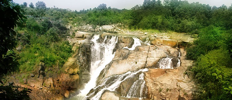

About 45 kms from Ranchi, enroute Jamshedpur, a motorable road branching off from NH 33, turns right towards Taimara village. It is here that the Kanchi River, a wild tributary of River Swarnarekha tumbles down from a height of 144 feet in full glory, to say the original name of the falls Da-Song, believed to be given during the British Raj, probably stems from the pristine beauty and the reverberations of the water at the falls. The ideal time to visit the place is between October to January and get rejuvenated in the lap of nature.
It can be reached through cars or private vehicles.
Hundru Fall
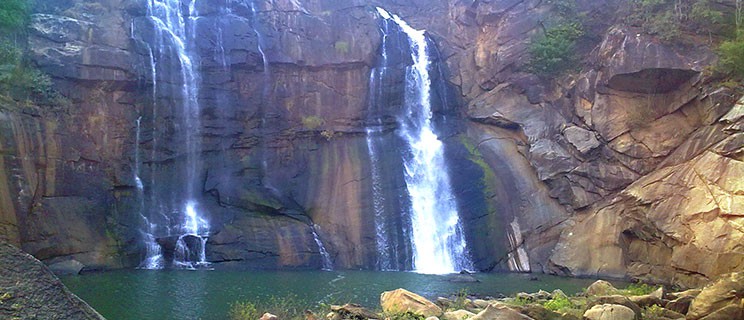

Hundru
Falls is about 45 kms away from Ranchi town, located on the Ranchi
Purulia Highway. The sight of the River Swarnarekha taking a spectacular
leap from a height of 320 feet instantly wears out your fatigue. At the
base of the falls the spirit of the water however mellows, gathering
into a frothy pool where the visitors may take a rejuvenating dip. The
place is also popular as one of the most admired trekking destination in
the state. The wrath of Hundru is at its peak in the monsoons, when its
waters unbridled and unchallenged, lash against the rocks. In summer,
however it proves to be a cool recluse for picnic lovers
Bhatinda Waterfall
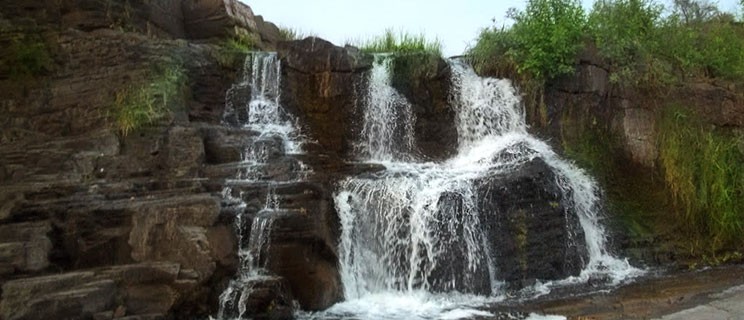

Here,
the wild torrents of the locally flowing rivulet Jamunia, gurgles down
in playful mirth and mischief across the rocks that have the natural
terrain of steps. It tumbles down from fairly a low height of about 10
metres. However, the beauty of the waterfalls lies in its cascading
effect, over the rocks. Located barely 15 kms from the town, site is
ideal for picnic revellers, who throng here during Christmas and New
Year. However, it is also a retreat for those wanting to rejuvenate
themselves from the mundane humdrums in solitude. It can be reached from
the Dhanbad-Bokaro Road (NH-32) about 25 kms from the railway station.
The road goes 12 kms inwards from Putki More, taking you to the site.
Usri Falls
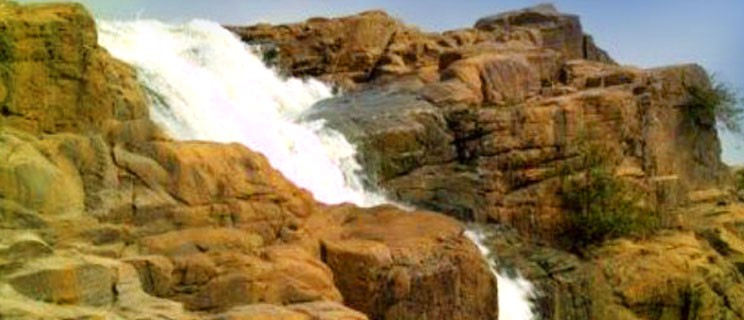

The untamed River Usri, gushes down from the Parasnath hill, about 40 feet high in three separate streams. It is located about 14 km away from east of Giridih Town. The National Highway 34 from Dhanbad to Giridih, branches in through a valley to rise up on a hill, midst a forest of Sal trees. Trailing this green forest road, you reach down slope, reaching the base of the falls. This is in the form of a broad stony surface, nearly 100 feet wide. The flow of the water in powerful torrents has sculpted the rocks and boulders in various shapes and sizes. They help you to balance your way in the midst of the waterfalls and bathe in its beauty.
It is hard to resist the rocks, laced by wild greenery and flowers growing in abandon coupled with the foamy and frothy waters that surge forth to greet you. Not to forget, there is also a watch tower which provides a wide view of the falls, till the southern hills of Parasnath. It is a favourite picnic spot, which is thronged by the revelers during Christmas and New Year.
Suga Bandh Waterfall
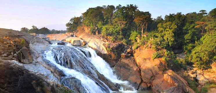

Suga
Bandh Waterfalls near Baresand is located in Latehar District of
Jharkhand. It is close to the Palamu Tiger Reserve and situated about 60
km from Betla.
Upper Ghagri
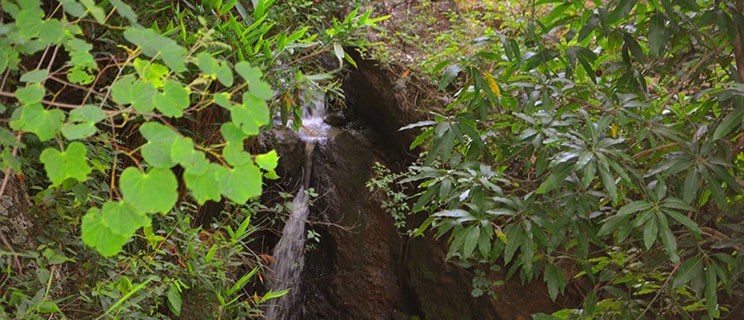

Ghagri” or “Ghagh” in local rural parlance means water falls. Here, the water of the overflowing dam makes a splash within a low valley, resulting into small water fall. The waterfalls from between the Gaaritaam and Ghagri hills on either sides. One may thus also enjoy trekking along the water spring. In the days of erstwhile British Raj and days of Zamindari. The site was locally called “Bhainsborwa” where buffaloes from large farm houses enjoyed bath in summer. The tall trees of chir pine and Sakhua add to the lush greenery. Not too far away are the famous nashpati orchards that stretch for acres. Watching the stooping boughs heavily laden with fruits in the months of June-July are sights to behold. The much in demand Nakh Nashpati are aslo cultivated here. To add to them, guavas too extensively grown in these orchards. The fruits are sent as far as the West-Bengal.
Moti Jharana
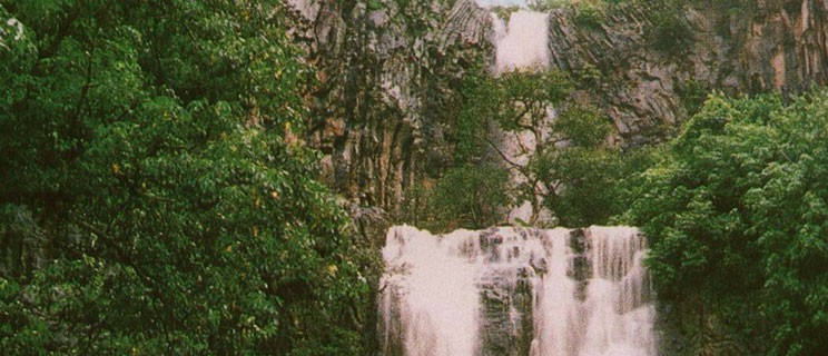

This spot is considered to be a very beautiful picnic spot in the region. The place gained fame for its natural, scenic beauty, which serves as a good relaxation spot for many visitors and tourists. A natural stream said to be having its source in the Rajmahal Hills of Sahibganj district, flows quietly and adds to the allure and charm of the place. Moti Jharna is situated near the town of Maharajpur which is 9.7kms from Sahibganj.
Mirchaiya Waterfalls
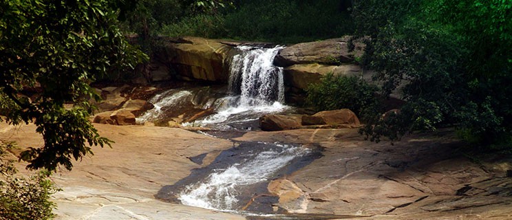

Mirchaiya Falls is located 3 km from Garu block of Latehar district. It is situated within the Betla tiger project reserve area. This is formed on the tributary of the North Koel river. It is composed of black granite lava flows which have deposited in the form of a lava dome over which the stream flows. It is located just 50m on the left of the Garu-Netarhat road.It is one of the safest waterfalls of Jharkhand. Accomodation and fooding is easily available at Garu. Buses ply from Daltonganj to Garu in morning and the last bus from Garu to Daltonganj leaves at 3:30 pm.
Patratu Dam
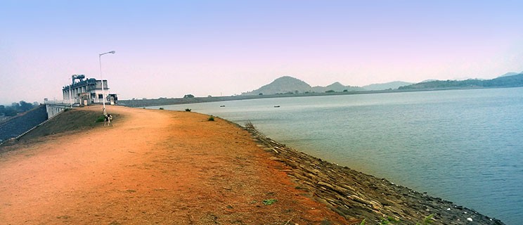

The dam was made to store water of Nalkari River; this is the main attraction of Patratu. One can see flying fishes during sunrise by sitting at the coast of the Dam. Very few people know there is a tunnel below the dam which connects two villages of Patratu named Labga and Hariharpur. Due to security reasons it has been closed for everyone.
Boating has been started from 14 January 2010 on dam. Patratu dam is located 30 km from Ramgarh and 35 km from Ranchi, the road to patratu dam via pithoria is picturesque.
It supplies water to Ramgarh cantonment area and act as the main reservoir of Patratu Thermal Power Plant (PTPS).
Tilaiya Dam
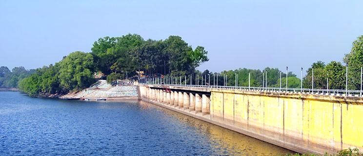

Across the Barakar River, the reservoir and the hillock offer fantastic sights. At Tilaiya, there is an exquisite lake surrounded by a hilly plateau. Boating is permitted in the lake where one can visit a whispering island which houses the jungle crocodile project. The Chacha Nehru Island is a heavenly place for a family picnic.
Tenughat Dam
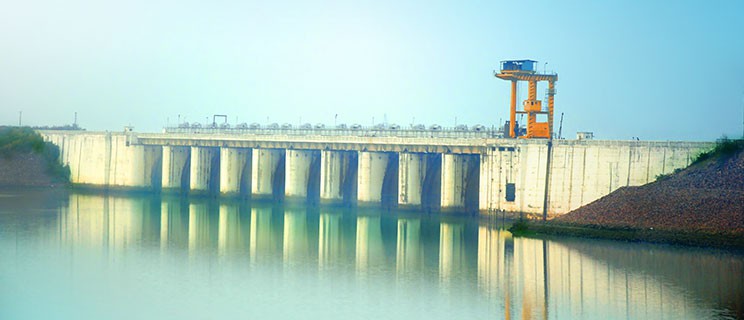

Located about 75 kms from Bokaro, it falls on Bokaro-Ramgarh Road (NH-33), via Gola. You take a right turn from Petarwar More, to reach this tranquil dam. Constructed in 1980, on River Damodar, it is 166 feet high, with an expanse of 30 sq. kms. It is an ideal site for boating and is frequented by picnickers particularly during the winters, the dam is the major source of water for the Bokaro Steel plant, which is fed through a 29 km long canal. About 15 kms away from the dam is the Tenughat Thermal Power Station at Lalpania.
The petarwar More, which is centrally located, can be reached through buses traveling from Bokaro-Ramgarh or Ranchi. From Petarwar there are easily available trekkers taking you to Tenughat, which is 20 kms away. Also, on the Dhanbad-Ranchi rail route lies the Tenughat station, from where the site can be easily reached.
Masanjor Dam


Massanjore dam situated across the Mayurakshi River in Dumka district of Jharkhand. The dam is about 155 feet high from its base and 2170 feet long. The reservoir has an area of 16, 650 acres when full and has a storage capacity of 500,000 acre feet.The dam was built with Candian aid, it is also called Canada Dam or Pearson Dam. It was commissioned in 1955. . It was formally inaugurated by Lester B. Pearson, Foreign Minister of Canada.
From the counterpart rupee fund created through supplies of wheat and other materials from Canada for use in India, Canada devoted those rupees to the further development of the Mayurakshi dam project.
It is about 25 kms from Dumka district and 45 kms from West Bengal. It is situated on Suri-Dumka road and accessible from Dumka via roadways.
Kanke Dam


Located on the Kanke Road, at 8kms from the Ranchi railway station and 12 kms from the Birsa Munda airport is the Kanke Dam. Covering an expanse of 8 sq.kms, the water body is overlooked by the Gonda hillocks. The huge dark boulders of the latter instantly catch the eye ever from a distance. The dam supplies potable water to nearly half the city’s population in the adjoining areas.
The arched staircase that leads down to the waters of the lake also offers a panoramic view of the sunrise and sunset. The waters of the lake shimmer in the lights of its illuminated banks in the evening. It can be easily reached through auto rickshaws and other locally available public transport.
Maithan Dam
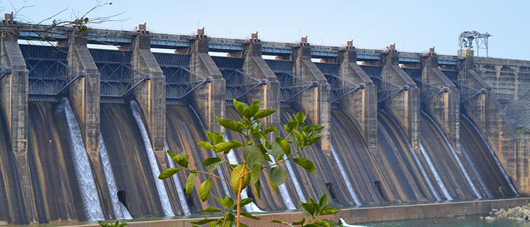

Named after, Mai-ka-sthan or abode-of-the-mother, from the temple of Kalyaneshwari in its vicinity, it is located 46 kms from Dhanbad. Apart from emerging a prominent religious destination, Maithon is also the site of the country’s first multipurpose project, it came into existence 1958 and has the biggest reservoir of Damodar Valley Corporation (DVC), on River Barakar. Height of the embankment is 56 metres and its length 4357 meteres.
It is also known for its underground hydel power station, the first of its kind in Southeast Asia. You can unwind form your stress even in the midst of the water. A deer park that has come up recently is an added attraction to your trip. There are short distance buses plying from Dhanbad to Maithon. It can also be reached in hired taxis or other light vehicles. The nearest railway station at Kumardhubi is just 10 kms away on the Dhanbad-Howrah rail route


