Location Gallery
Baradari
Baradari
Tower Chowk

Tower Chowk
Ulihatu (Birth Place of Bhagwan Birsa Munda)
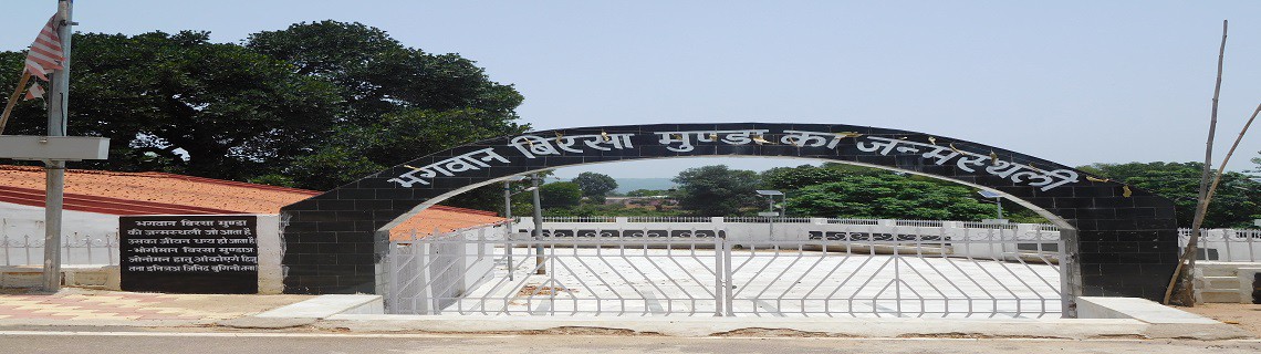
Ulihatu- Birth place of Bhagwan Birsa Munda
Luguburu Ghantabari
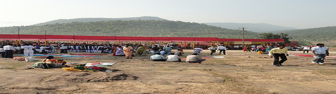
Luguburu Ghantabari situated near TTPS Lalpania a small village of “Santhalis” a group of Tribal , about 16 kilometer far from Gomia Block is the pride of Santal community since the period of civilization called Sosnok Jug in Hor-dishom. Luguburu Ghantabari Dharamgarh was re-established in the year 2000. Then the every year religious gathering is held at Darbar Chatani under foot hill of Luguburu in the lap of famous Lugu hill series (The second highest hill series of jharkhand) and surrounded with Jharkhand’s famous river Damodar and small hilly
rivers Katail and Sadabahar , situated in the north side of Tenughat Dam. On Kartik Purnima a famous Mela of Santhalies is organized here & Santhal tribal of all over India use to come here to offer prayer to their lord LUGU BABA. “Pahan” use to perform the puja.
Shyamali a guest house of T.T.P.S is a beautiful building, constructed on road side hill top. A typical scene of Tenughat water reservoir, Luguburu hills , snake like roads can be observed from its rooftop. At the bottom of Shyamali and besides the Lalpania Gomia road a very attractive statue of “Birsa Bhagwan’ is made.
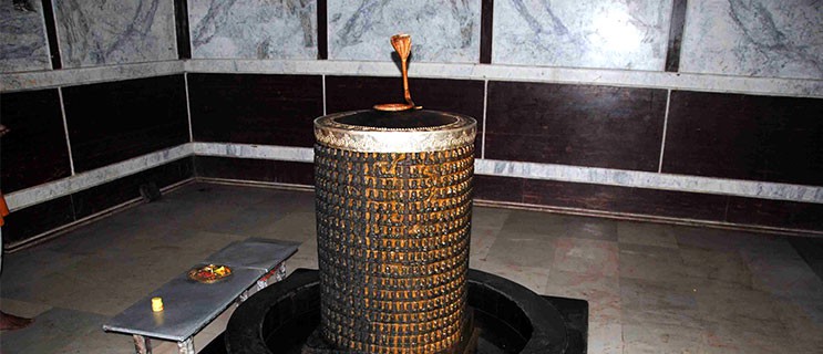
A small but very pleasant water fall is adding in the beauty of Lalpania, here water is falling from a height of approx 15meters and at the bottom of the fall a big cantilever stone creating cave like scene , a shiva linga has been placed in side there by famous local holyman Shri Ram Sharan Giri adding spiritual atmosphere.
Deuridih Rural Tourism
Located in the Kharsawan block, 54 kms from Jamshedpur, the village is a part of the silk hub of the state. Jharkhand today, is the highest producer of Tassar silk hub of the state. Jharkhand today, is the highest producer of Tassar silk in the country. There are rows of Arjun and Asan plants, where the silk worms are reared. About 8 kms from the village is the Govt run reeling and spinning training institute of silk. About 30 women belonging from the ho community are being trained in the art, The Tassar-cocoon pilot project is also close by, in between Deuridih and Amda. To add to the above, the village is also trying to revive the Kharsawan form of Chhau, from extinction.
It is on the way to Kharsawan-Kuchai Road, the village falls on the left, next to the Kharswawn block office. The nearest railway station of Raj Kharsawan is about 9 kms from the village. There are two state guest houses in Seraikella, about 15 kms away.
Itkhori
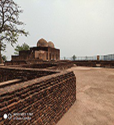
Itkhori, a block headquarter within Chatra district. Itkhori lies north of Hazaribagh, about 16 kms west of Chouparan to be more precise. It is a wonderful place with abundance of historic reminiscences and archaeological remnants demonstrating a breath-taking saga of religious tolerance and cultural unity. More than 1200 years ago the great Pala and Gupta emperors looked out from the terrace of the magnificent Maa Bhadrakali temple complex built during 9th Century. The workmanship of the images and statues indicate a highly developed heritage of skills in the finer arts. And if wonders were to follow wonders, the Shiva-linga in the adjacent temple has no less than 1008 'lingams' carved into its surface. Images of 104 Bodhisattvas and 4 principal Buddha’s are sculpted on each side of a 'stupa'-like structure.
One of the rock inscriptions of Mahendra Pala at Itkhori indicates that the Pratihara ruler came in control of the bordering areas of Chotanagpur during second half of the 9th century A.D.
All these magical remnants of the past are to be found at Itkhori, a village north of Hazaribagh, an ancient place where the religion and cultures of Hinduism, Jainism and Buddhism, came and blended centuries ago. There are various Buddhist Relics at Itkhori dated from 200 B.C to 1200 A.D. Itkhori's name also has a legend connected to Buddhism. When the aunt of Lord Buddha could not distract him from meditating she gave up, goes the legend saying. If/ Khoyi (lost here) that eventually distorted to become Itkhori, the name of the place.